Long-awaited modelling reveals serious flooding threat for Docklands, Southbank and Fishermans Bend
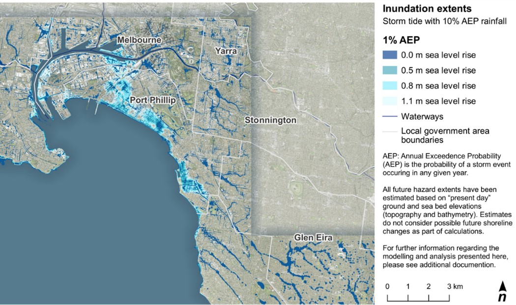
Image credit: Victorian Government
In news that nobody wants to hear, a government study recently released under an FOI request has unveiled the severe risks that climate change poses to homes, infrastructure, and beaches around Port Phillip Bay.
The Port Phillip Bay Coastal Hazard Assessment, commissioned six years ago, offers a detailed map of the impacts of sea level rises along the bay’s 310-kilometre shoreline.
It predicts a drastic increase in inundation due to a combination of higher sea levels, stronger tides, bigger waves, and changing groundwater levels.
The most alarming scenario includes a 1.4-metre sea-level rise by 2100, which could put nearly five square kilometres in central Melbourne (including Docklands, Southbank, and Fishermans Bend) at risk during extreme storm events.
The findings are already causing a stir, with the State Government and local councils at odds over who should take responsibility for guiding future development in light of the findings – and facilitating sensitive discussions about potential relocations or buybacks of land.
But Victoria’s environment minister, Steve Dimopoulos, has urged all interested parties to remain calm.
‘This is a report for the next 80 years, not a report for the next five minutes. I wouldn’t be asking any community to be up in arms and concerned other than just to be informed and work with land managers and to take mitigation efforts.’
Want to get a piece of the action on some of Melbourne’s most iconic builds?
Head to the Building Environs website to view exciting – and available – positions in some of Melbourne’s biggest firms.